



 UN
UN 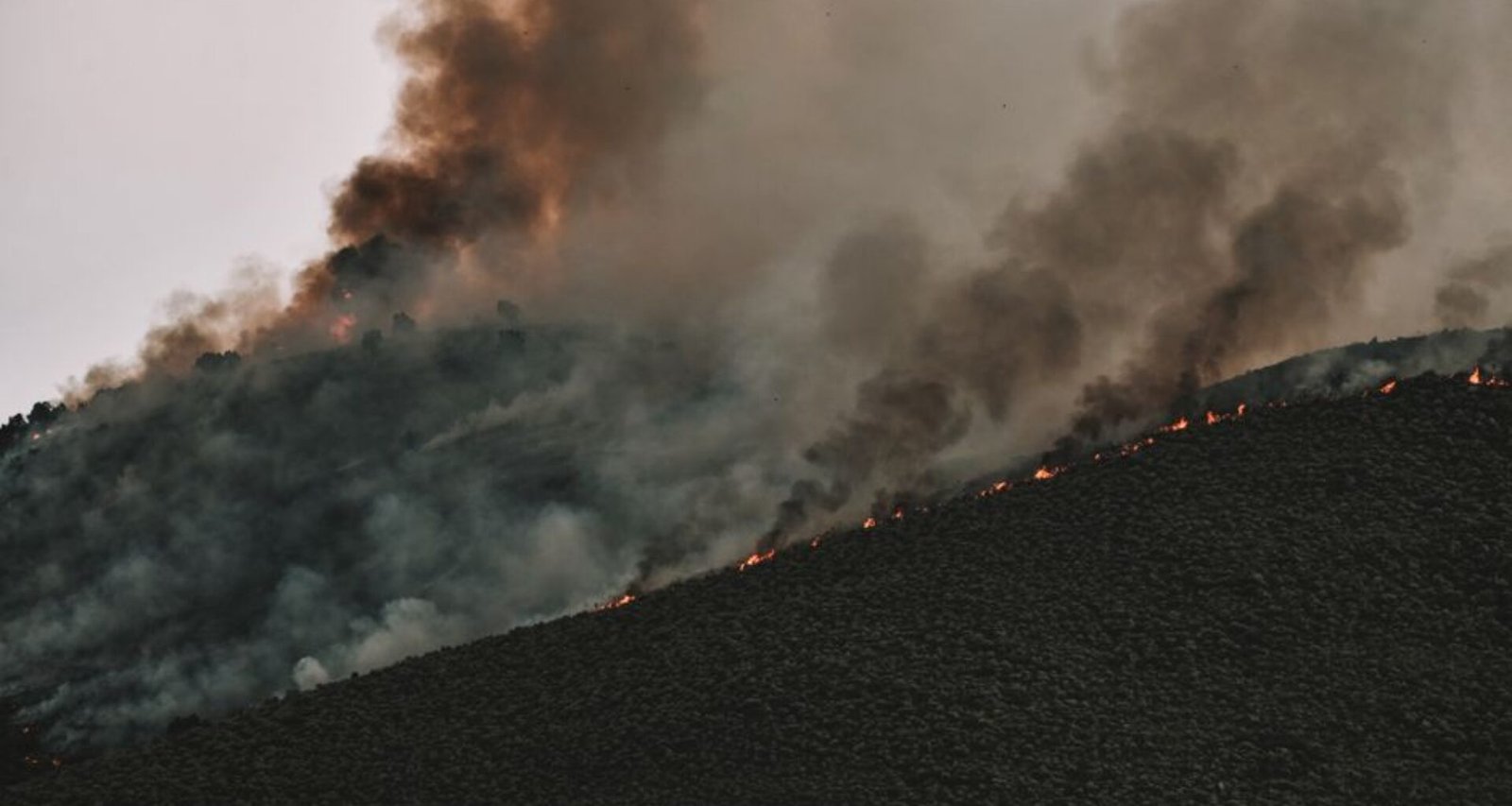
Saturday afternoon saw a thick haze settle over Pendleton as IQAir’s wildfire map tracked multiple active fires across north-central and eastern Oregon. By midday, the state’s Department of Environmental Quality had issued air quality advisories for Umatilla, Baker, and Grant counties, with PM2.5 readings exceeding 120 µg/m³—well above the EPA’s 35 µg/m³ daily standard.
The fires, ignited earlier this week amid record-breaking temperatures—several weather stations reported highs above 40°C—are straining local emergency services and raising concerns about rural resilience. The Oregon Office of Emergency Management confirmed evacuations in several small communities, while the Confederated Tribes of the Umatilla Indian Reservation have opened cooling centers for elders and young children.
IQAir’s live data, used by public health officials and disaster response teams, has become a crucial tool in tracking the rapid shifts in air quality. According to Dr. Melissa Kwan, air monitoring coordinator for the state, “Real-time AQI data is guiding our resource allocation and health advisories. We’re seeing particulate spikes every evening as wildfire activity intensifies.”
As summer tourism peaks, local businesses in Baker City and La Grande are reporting a sharp drop in outdoor activity. Hotel occupancy in key recreation areas has fallen by 30% compared to early July, and several regional summer festivals have been postponed or moved indoors—disrupting an already fragile post-pandemic recovery.
Oregon’s 2026 Wildfire Response Plan, launched in May, includes new funding for community firebreaks and air filtration systems in public buildings. But with only 40% of these upgrades completed by August, environmental advocates warn that adaptation efforts are lagging behind the pace of climate-driven fire seasons. State officials are expected to release an updated progress report later this month.
Frequently Asked Questions
What were the PM2.5 levels during the August 2026 eastern Oregon wildfires?
PM2.5 levels exceeded 120 µg/m³ in Umatilla, Baker, and Grant counties, far above the EPA’s 35 µg/m³ standard.
How did the wildfires affect tourism and local businesses in eastern Oregon?
Hotel occupancy in recreation areas dropped by 30% and several summer festivals were postponed or moved indoors due to poor air quality.
What percentage of Oregon’s 2026 Wildfire Response Plan upgrades were completed by August?
Only 40% of the upgrades, including firebreaks and air filtration systems, were completed by August.
How did the Confederated Tribes of the Umatilla Indian Reservation respond to the wildfires?
They opened cooling centers for vulnerable residents, including elders and young children, amid evacuations.
What role did real-time air quality data play during the wildfires?
Real-time AQI data guided resource allocation and health advisories, with officials noting particulate spikes every evening as wildfire activity intensified.